


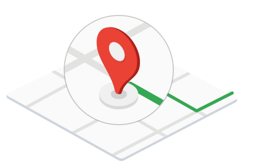
Mapping the future with Google Maps Platform
Google Maps Platform is celebrating the 15 years it has been offering its maps, discovering new ways of changing the way the world moves and helping companies like yours. In this post we will show you what the future looks like: new routes created by machine learning, data information and more.
EXPLORE THE INTERACTIVE TIMELINE OF GOOGLE MAPS PLATFORM
What’s new?
Google Maps Platform presents you with new ways of attracting customers. You can easily customise maps, integrate the local context and take the real world to games.
LOCAL CONTEXT
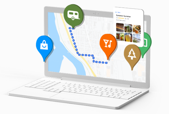
Local Context integrates relevant local information into your maps simply, enabling the customer to explore a new area with ease.
It shows your customers the places of interest near to the location that you choose, without leaving your website, thanks to Google’s wealth of local information.
Give a new direction to local context
Discover how local context makes it easy for a customer to explore a new area.
It integrates local information easily into your maps
Google Maps Platform presents a simple way of adding local information from Google to your maps. This turnkey experience enables you to display specific details of nearby areas so that users can see ratings, comments, photos and directions without having to leave your web application. In addition, you can customise it to adapt it to your business.
Display local information with a simple and turnkey tool
Local Context combines the best of Maps, Routes and Places (the three large blocks of APIs from GMP) in one single experience. It allows customers to interact with data from Places and is easy to maintain. Furthermore, you can implement it with just a few lines of code.
Keep your customers interested in your website application
Offer your customers the experience of Google Maps that they are already familiar with directly on your web application, without the need to open a new tab or application. It allows customers to explore an area by clicking on pins or on a photo gallery that represents nearby places.
Customise your map to satisfy your requirements
Help your customers to make fast decisions by only displaying the relevant place types. Select how many of each type and how many places in total you want to display on your map. Change the appearance of the map to match your web application. Customise the colours of the pins and place icons, and the position of the key elements of the user interface.
Offer a local data-rich experience
Allow your customers to view ratings, reviews, photos, prices, etc. simply by clicking on a pin or photo. In addition, you can display the estimated time of arrival for walking and directions to the points of interest when a customer clicks on a pin or photo.
Immerse yourself in the local context
Discover this new feature and how to implement it. (Currently in BETA version)
CUSTOMISABLE MAPS
The new options of customisation facilitate creating a map which is fully adapted to your business.
Try the new customisation features of Maps
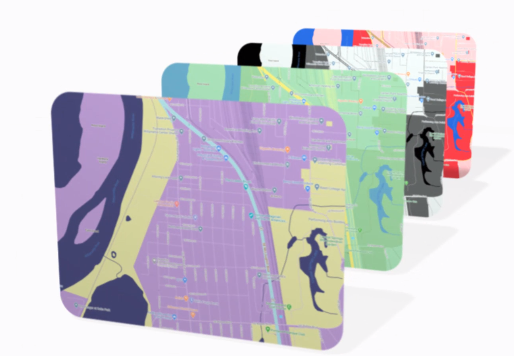
Use the new style tools to create a customised map of any location you choose. It is extremely easy to post updates on all devices and platforms.
Now, it has more style features to help your business to stand out from the competition. You can apply different styles to your maps on Google Cloud Console and manage them without touching a line of code.
Update all of your maps easily in real time
Implement updates of maps in real time on all of the platforms and devices without editing a single line of code. Manage maps easily through the Google Cloud Console without any problems and provide an optimum customer experience.
Choose the places you display
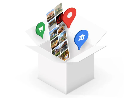
Decide which types of companies customers will be able to see on your map with Business POI Filtering. Choose from five new business categories to reduce the points of interest on your map and only display the most useful information to your customers.
Offer clear and simple maps
Decide how any points of interest you display on your map with POI Density Control. Mark the categories that your customers are most interested in and mark those that are less relevant
Create more seamless and attractive maps
Create sharper and clearer maps thanks to vector graphics that don’t pixelate. Enable seamless browsing with Vector Maps for JavaScript.
Immerse yourself in the customisation of Maps
Discover this new feature and how to implement it. (Currently in BETA version)
VIDEO GAMES
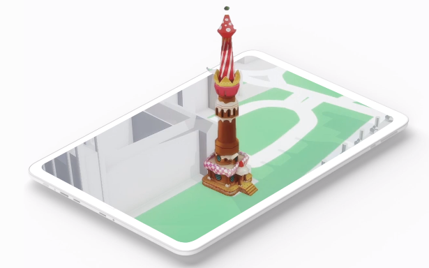
Take the real world to your video games
Now anyone can create immersive gaming environments based on buildings from the real world, roads, parks and more.
Take popular places or points of interest to players from Google Maps with data from more than 150 million places.
Turn the real world into your game world
Access hundreds of millions of 3D buildings, roads, points of reference, cafés and parks from the real world to build your game. Google Maps Platform has a map of the world, so you can have high quality data from New York to Tokyo, including information about more than 100 million places
Fully personalise your video games
Roads, buildings and parks become gaming objects in Unity, where you can personalise any element of the game. Fill parks with trees, oceans with waves and beaches with parasols. Personalise the colours, textures and size of the objects to create your own game.
Find suitable and friendly places for players to play in with data from Google Maps.
Trust Google to grow to scale according to your needs
Building with the infrastructure and servers of Google Maps throughout the world means faster response times, the ability to scale to demand and the peace of mind of knowing that your games will work, even during sudden peaks in traffic.
